Navionics Charts Explore
Nautical Charts - Navionics Plus and Platinum Plus


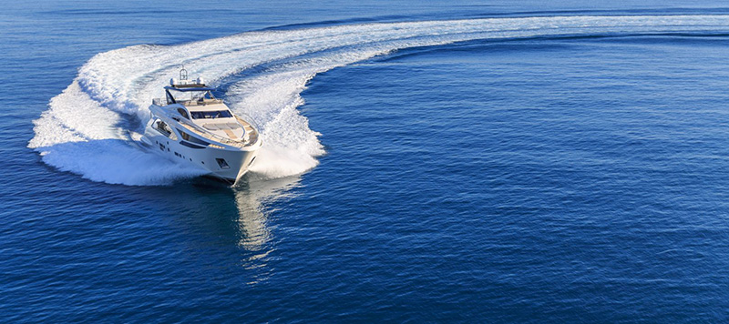
Power in your hands
The most accurate and thorough set of information created for marine and lakes. All essential cartographic reference detail for cruising, sailing and fishing: port plans, safety depth contours, marine services, tides, currents, and navigation aids.

Enriched over 30 years
Continuously expanded with data from numerous highly qualified public and private sources, including our own surveys, Notices to Mariners and data reported by users.

Plotter, mobile and PC!
Enjoy a consistent experience on every device. On plotter, find the same presentation across a wide range manufacturers. On mobile and PC, just download one Navionics Boating app and select your region. See our charts for free on the Chart Viewer.

Daily Updates!
We make around 2,000 updates to Nautical Chart every day! On plotter, download it through Freshest Data, the updates service included fre for one year with any card. On mobile and PC, go to Menu>Update All (or Download Map). See the most current charts on our Chart Viewer.

Award-winning
Our Nautical Chart has been honored with recognition and awards around the world. It's internationally renown as a top-notch reference, both for private boaters and by eminent companies that employ our charts in their everyday business.

Join the crowd
Many customers are already helping us for the benefit of the entire community. We update our charts every day, but you may be aware of changes in sea or lake data just because you are on the spot; let us know of them! File a Discrepancy Report or use Community Edits within our Boating apps.
Community Edits - Navionics Plus and Platinum Plus


Local inputs, great benefit
Thanks to millions of Navionics app users who are continuously on the water, all kinds of valuable local information is constantly enhanced such as seasonal buoys, lights, rocks, moorings, boat ramps, and points of interest like restaurants and provisioning shops.

Millions of boaters
Additions to Navionics Nautical Chart are shared by millions of users from every part of the world. Think of the value of receiving recommendations about places you don't know from people who have experienced them directly before you! All inputs made through our Apple and Android mobile apps are available to every Navionics customer on plotter & mobile.

Leave your mark!
Become an author by adding any information you believe might be of interest to you and other boaters simply by registering from the app and then selecting the icon that represents the object you want to insert (or, you can ask navioinics to modify the official data).

Self-monitored
Any user can comment, rate, modify or delete Community Edits. All edits are signed by registered users. Community Edits are a separate layer from official data and can be switched on and off.

Plotter & mobile!
Community Edits are entered from Apple and Android apps only, but are available on plotter and mobile. On plotter, they are available with any Navionics card. Simply select the layer and keep it up to date with Freshest Data (just make sure your plotter is able to show them). On mobile, go to Menu and switch them on.
SonarChart - Navionics Plus and Platinum Plus


High Def 1 ft/0.5 m detail
SonarChart is an HD bathymetry map featuring extraordinary bottom contour detail, great for increasing awareness of shallow waters and for locating fishing areas at any depth level.

Want better charts? Go boating!
Get the most up-to-date charts every day. Navionics integrates the sonar logs from individual users with existing data to ensure the SonarChart becomes more and more precise, even in the ever-changing conditions of sea, lake and river bottoms. Only Navionics accepts sonar logs from all major plotter/sonar brands and mobile devices.

Plotter, Mobile & PC!
Get SonarChart on any device! On compatible plotters, it's included with Navionics+, Navionics Updates (for Gold and HotMaps Premium), Platinum+ and HotMaps Platinum. On mobile, find it in any Boating app on Apple and Android.

Create a new SonarChart!
Save to any card and upload. Plotter Sync is a simpler alternative, but the easiest, most impressive and automatic process is with SonarChart Live.

SonarChart Live!
Use your plotter/sonar or mobile device to create personal 1 ft/0.5 m HD bathymetry maps in real time with SonarChart Live.

Upload from your boat!
Raymarine Wi-Fi device users don’t need to remove a card from their plotter to upload sonar logs. They can do it directly from the boat using Plotter Sync. This advanced feature also allows transfer of routes/markers, download of new areas, updates and activation of a new Navionics+ card. Raymarine MFD and Dragonfly PRO users can more conveniently perform sonar log uploads with SonarCharts Live.

See the HD results!
Check the processing status of your sonar logs and see them on the map! New sonar log data normally takes about a week to be integrated within SonarChart, but may sometimes take longer based on data process variables. Once ready, see the new SonarChart on plotter by updating charts via daily updates. On mobile, just tap Menu>Update All.

Coverage
SonarChart is available for all Navionics coverage areas, except West Africa. We accept sonar logs and integrate the data wherever SonarChart exists and also welcome data from other areas for possible future use. Sweden, Norway and Finland restrict sonar logs recording at sea.
Daily Updates - Plus and Platinum Plus


The most current charts every day
Only Navionics customers can enjoy this unique benefit: the most current charts every time they go boating. Have a new Navionics card? Get one year of daily updates when you register your card online within 2 months of product purchase. The Navionics Boating app also offers daily updates for one year.

Don't miss important changes
With our daily updates subscription, you can have all the latest content:
-Nautical Chart, essential cartographic reference detail with hundreds of thousands of updates each year.
-SonarChart, 1 ft/0.5 m HD bathymetry map you can enhance.
-Community Edits, local inputs added by millions of Navionics mobile and plotter users throughout the year.

More than 2,000 daily updates!
We constantly enhance our charts with new and amended content from official hydrographic sources, public and private surveys, and millions of contributions from boaters. More than 2,000 updates are made every day to our Nautical Chart.

Advanced features
Now on Raymarine, Lowrance, Simrad and B&G, boaters also have the opportunity to benefit from advanced features:
Dock-to-dock Autorouting
Dock-to-dock Autorouting, a unique breakthrough in boating navigation, quickly creates detailed routes even through narrow passages and channels, based on chart data and navigation aids.
Advanced map options
Customize your view of Navionics charts by highlighting shallow areas, selecting a fishing range or adjusting SonarChart™ density.
SonarChart™ Live
SonarChart™ Live allows you to create new personal 1 ft/0.5 m HD bathymetry maps that display in real time while navigating. The feature can be displayed directly on the screen of compatible plotters, or on a mobile device within the Navionics Boating app when connected wirelessly to a sonar.
Plotter Sync
If you own a compatible plotter from Raymarine, you can use Plotter Sync to transfer routes and markers, upload sonar logs, download new areas and updates to your card, and activate a new Navionics+ card wirelessly by connecting an iPhone, iPad or Android with the Navionics Boating app to your plotter.

Update frequently!
- Plotter Cards. With the updates subscription you can keep your charts up to date by inserting your card into a PC, directly or using a card reader. You can also do it from your boat using Plotter Sync.
- Mobile app. Go to Menu>Update All.

Card subscription expired?
Update the easy way and get a new card with up to 50% off. We’ll ship it right to your door, preloaded with charts and activated for daily updates and advanced features.
Similar savings also apply to these update methods:
For Navionics+, Gold, HotMaps Premium, Marine & Lakes, or Silver:
-Update your card online (not recommended for cards less than 2GB)
-Buy a Navionics Updates card from a dealer and use your other card to activate it.
For Platinum+ & HotMaps Platinum:
- Update the cartographic content online (panoramic pictures and satellite overlay don’t get updated with this method).

Mobile charts subscription expired?
When the updates for your mobile app charts expire, purchase a Navionics+ subscription from Menu>Shop>Purchased or follow the messages appearing within the app.
Dock-to-dock Autorouting - Plus and Platinum Plus


A unique breakthrough
All autorouting existing today can find a route from A to B only if they are both in open water, while good guidance and planning is most needed in cramped complex waterways with a maze of variables. A unique breakthrough in boating navigation, Navionics Dock-to-dock Autorouting, instead, quickly calculates a detailed route even through narrow passages and channels, based on chart data and navigation aids.

On your GPS plotter
Dock-to-dock Autorouting is possible on Raymarine MFD units and also now on Lowrance, Simrad and B&G models. Available worldwide (not in USA on all plotters).

On your mobile
Download the free version of Navionics Boating for your phone, or Boating HD for your tablet and experience Dock-to-dock Autorouting with your free trial of Navionics+. Or choose any paid app version where Navionics+ is already included.

Plan your route
Choose your destination by selecting a point of interest, entering a lat/long or by tapping on the map. Dock-to-dock Autorouting quickly calculates a detailed route. However, always keep in mind that automatically calculated routes do not replace safe navigation practices and should never be your only reference.

View route details
You can see your estimated fuel consumption, distance and ETA.

Observe route precautions
Suggested routes even highlight precautions along the way for shallow water, bridges and other hazards.

Automatic points of interest
On the Boating app, find points of interest (POIs) nearby the destination, like the harbor master, marinas and moorings, fuel stations, restaurants and bars, shops, taxis & launch services, repairs, and dealers. They appear automatically within the Autorouting menu, complete with phone numbers and other valuable information like VHF channels for marinas.
SonarChart Live - Plus and Platinum Plus


Create your own maps
SonarChart Live allows you to create new personal 1 ft/0.5 m HD bathymetry maps that display in real time while navigating. The feature can be enabled by connecting wirelessly to a sonar from your mobile that has a Navionics Boating app installed. Alternatively, it can be displayed directly on the screen of compatible plotters.


On your iPhone, iPad or Android
On your Boating app create personal HD bathymetry maps that display on your device in real time, when connected wirelessly to a sonar. The new chart appears as an additional layer over your map while it also gets stored on your device for future use. The amazing SonarChart Live is an embedded, free feature available on both Apple and Android.

Target fish-holding structure!
See the school of bait fish with game fish underneath!

Stay alert to changes in the seabed
Viewing sharp changes in slope helps raise awareness to risky situations

Dive with intelligence using SonarChart Live
View the depth and shape of the seabed floor before exploring new spots

Want Better Charts? Go boating!
Depth data recorded while doing SonarChart Live generates a stream of data shared with Navionics to improve SonarChart for all boaters. Navionics integrates the sonar logs from individual users, with existing data to ensure SonarChart becomes more and more precise, even in the ever-changing conditions of sea, lake and river bottoms. Only Navionics accepts sonar logs from all major plotter/sonar brands and mobile devices.

See evidence of your survey
SonarChart Live is an excellent way to monitor the improvements your survey will bring to the SonarChart because contours are instantly seenwhile you're collecting sonar logs. You may check your logs processing status and see them on the map. The new SonarChart, resulting from your and others’ sonar logs, checked and interpolated with existing Navionics data, will be available after about one week

Lowrance, Simrad and B&G
The HDS Gen3 and Elite Ti fishfinder/chartplotter units with built-in wireless connectivity enable SonarChart Live to display on the Navionics Boating app in real time while navigating. Other Lowrance, Simrad, and B&G plotters and sounders can display SonarChart Live in combination with the GoFree WIFI-1 Module.

Compatibility
Experience SonarChart Live your way. Check our continuously updated SonarChart™ Live compatibility guide, to find the solution that fits your needs.

How to: Mobile
Close any apps that may have used the compatible device’s Wi-Fi. Connect your mobile to the Wi-Fi of the device, then open the Navionics Boating app. A new map is created instantly on-screen as you move across the water. Adjust color and transparency with Menu>Map Options>SonarChart Live Settings. In case your logs don’t appear on the process status page, close the app and reopen it.
Plotter Sync - Plus and Platinum Plus


Plotter Sync
Plotter Sync allows Raymarine, Lowrance, Simrad and B&G plotter owners to transfer routes and markers, update charts and more! Active subscriptions are required on both the plotter card and the app.
Transfer Routes & Markers
Easily transfer routes and markers between your plotter card and mobile app! A great time saver!

Update your charts!
We make around 2,000 updates to our Nautical Chart daily, plus several thousand updates are also made to SonarChart and Community Edits! Update charts on your plotter card to get the most current data via Plotter Sync!

Activate & Renew
From your boat, you can activate eligible Navionics+, Platinum+ or HotMaps Platinum plotter cards to enable daily chart updates and advanced features. (Apple & Android)You can also renew your plotter card subscription for another year. (Apple & Android)
Plus, if you’ve done Plotter Sync once before, you can quickly renew from your mobile: just go to Menu>Device Connected(on Apple devices).

Raymarine
Plotter Sync is compatible with Raymarine MFDs a, c, e and gS Series from 2011 using LightHouse II release 10 or newer software or the Dragonfly PRO.
Raymarine users can also upload sonar logs for improved SonarChart™ even without an active subscription on plotter or mobile! Learn how to use your compatible Raymarine model to enhance SonarChart™ by contributing sonar logs.

Lowrance, Simrad and B&G
Lowrance HDS Carbon, HDS Gen3, Elite Ti 5 and 7, Simrad GO, GO xse, NSS Evo3, and B&G Zeus3 and Vulcan models are compatible with Plotter Sync provided they have the most current software installed. The latest version of the Navionics Boating app is also required. Similar software updates will soon be released for Lowrance Elite Ti 9 and 12.
Advanced Map Options - Plus and Platinum Plus

Customise your view
Boat Safer. Fish Smarter. Change the way you view Navionics charts and focus on the details that matter most to you. On plotter and mobile.

Highlight shallow areas
Whether you want to target shallow areas for sight fishing or avoid damaging your prop, recognize them at a glance by shading up to your preferred depth.

Adjust contour density
Sometimes less is more. Very steep drop-offs can result in overlapping contour lines. Now you can see more clearly by lowering the density level.

Select a fishing range
When you know the fish are suspended over certain depths, highlight the range so you can quickly identify more places to check out.

On Raymarine
Access each of the new features on your compatible Raymarine by selecting Menu > Presentation > Advanced Options. Be sure to update your chartplotter's operating software and use a Navionics card that has an active chart updates subscription.

On Lowrance, Simrad and B&G
Access each of the new features on your compatible model by selecting Menu > Chart Options > View. Be sure to update your chartplotter's operating software and use a Navionics card that has an active chart updates subscription.

On your mobile
Download the free version of Navionics Boating for your Apple or Android and access Advanced Map Options with your free trial of Navionics+. Or choose any paid app version where Navionics+ is already included. Advanced Map Options on mobile also includes satellite and terrain overlay.
Satellite Overlay - Platinum Plus

Situational awareness
Especially helpful in congested ports and marinas, crisp satellite overlay can also help you find hidden features such as backwater channels that might hold fish.

Set your display
Satellite overlay can be displayed on land only, land and shallow water or full overlay.

Adjust transparency
The opacity can be adjusted so that Navionics charts are fully or partially visible through the satellite overlay. This is helpful in shallows waters such as marsh areas or shoals and sandbars.

On Platinum+ and HotMaps Platinum
3D View is possible with Navionics Platinum cards when used with compatible models from many brands.
3D view - Platinum Plus

Optimize your display!
Dynamic 3D View allows you to customize your chart to highlight key features for a better awareness of your surroundings.

Pan & Zoom
Enjoy a broad overview, easily pan around the map and zoom in to any area you are interested in.

Exaggerate chart features
Increase exaggeration to Intensify and highlight subtle changes in bottom contours while following a channel or looking for good spots to fish!

Adjust Pitch and Rotate
Adjust pitch to change your vantage point from direct top down overview, which is standard for 2D, all the way to a nearly horizontal view. Rotate the chart to any orientation to get a more direct heading view of a harbor or marina entrance. Boaters find this helpful when planning or previewing their trips.

On Platinum+ and HotMaps Platinum
3D View is possible with Navionics Platinum cards when used with compatible models from many brands.
Panoramic Photos - Platinum Plus

Find the perfect port!
Panoramic photos give a better sense of the surroundings so you can evaluate your options.

Marinas
Heading into a new marina can be less stressful when you have an understanding of the layout that only a picture can provide.

Dock layouts and boat ramps
Whether large or small, don't just find your destination, recognise it!

View on your plotter
Select the camera icon with your cursor to display the photo on your GPS plotter screen when using a Platinum+ or HotMaps Platinum card.

View on your mobile
Target the green camera icon using the cross-hair then tap to view the photo.