

Garmin Navionics+
Garmin Navionics+ Marine Charts for Garmin Plotters
Premium Navionics+ charts optimized for Garmin chartplotters. Our collection features detailed marine charts with daily updates, SonarChart bathymetry, and advanced features integrated into Garmin's interface.
Garmin Chart Features: Part of our Cartography collection. Includes Community Edits, Dock-to-Dock Autorouting, and SonarChart Live. Use our Chart Finder for region selection. Compare with C-MAP or standard Navionics+ charts. Essential for Garmin GPSMAP and ECHOMAP systems.


Picking the right chart coverage
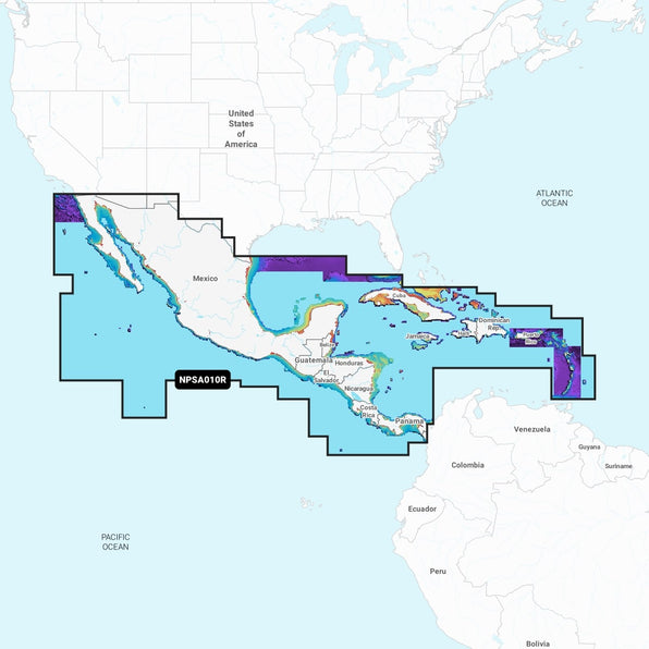
Coverage area is the first decision, not chart type. Navionics+ charts for Garmin are sold by region, so check the boundary of the area you actually cruise before comparing tiers, rather than assuming a wider chart automatically covers your local waters. Charts load from a microSD card into the plotter's card slot; older GPSMAP and ECHOMAP units may need a firmware update before they will read the newer card format.
SonarChart Live and community edits update in the background once the plotter has a data connection, either through ActiveCaptain on a phone or a networked Wi-Fi module, so the chart on screen keeps improving after the initial purchase. Bathymetric detail from SonarChart is built from other boaters' sonar logs, so accuracy varies by how well travelled an area is.
If you are not sure which region card your plotter needs, send us the model number and we will check it for you.

