


Garmin
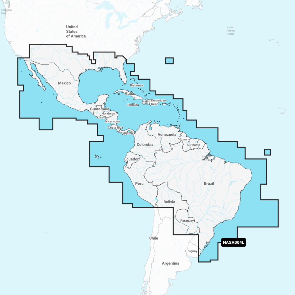
Navionics Mexico, Caribbean to Brazil - NASA004L
Pickup available at Mercury Yacht Harbour
Usually ready in 2-4 days
Description
Garmin Navionics+ charts for Mexico, the Caribbean and Brazil give detailed nautical cartography across these waters, taking in the US Gulf and east coasts, the Bahamas, the Greater and Lesser Antilles, the Panama Canal and the South American coast. The card provides depth contours, harbour and marina detail, navigation aids and tides and currents, with one year of daily chart updates from activation, plus Auto Guidance, dock-to-dock autorouting, depth shading and community edits.
Navionics+ and Navionics Platinum+ cards are not compatible with Garmin chartplotters; check your chartplotter's Navionics compatibility before ordering.
PRODUCT DETAILS
- Detailed charts for Mexico, the Caribbean and Brazil
- One year of daily chart updates from activation
- Auto Guidance and dock-to-dock autorouting
- Depth shading and community edits
- Not compatible with Garmin chartplotters
No exploded diagram available for this product.
No compatible transducers listed for this product.
No spares or accessories listed for this product.
No compatible products found.
Cartography
| Product line | Navionics+ |
| Coverage area | Mexico, Caribbean to Brazil |
| Region code | NASA004L |
| Media | microSD/SD card |
| Updates | One year of chart updates from activation |
Compatibility
| Compatibility | Navionics+ and Navionics Platinum+ cards are not compatible with Garmin chartplotters; check your chartplotter's Navionics compatibility before ordering. |
No videos available for this product.
No downloads available for this product.
No frequently asked questions for this product.


